I squeezed in the Bendigo Graveleur last week, from Thursday afternoon to Saturday midday. This is a quick recap of the ride.
Credit to Pete at Adventure Cycling Victoria for coming up with the route. Check out his write-up for a more comprehensive write-up:
Bendigo Graveleur
The original itinerary by Pete at Adventure Cycling Victoria
Route
Here’s Pete’s original Ride With GPS route:
I went the same way (anti-clockwise) because camping options seemed more plentiful on the western side.
The elevation profile and map show the steep climbs you’ll face early-on this way but they don’t reveal how much of a pain in the arse the Goldfields Track can be. There’s no way I could have made the Leanganook campsite (which I planned to) without starting earlier in the day.
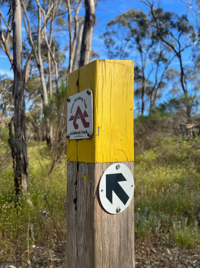
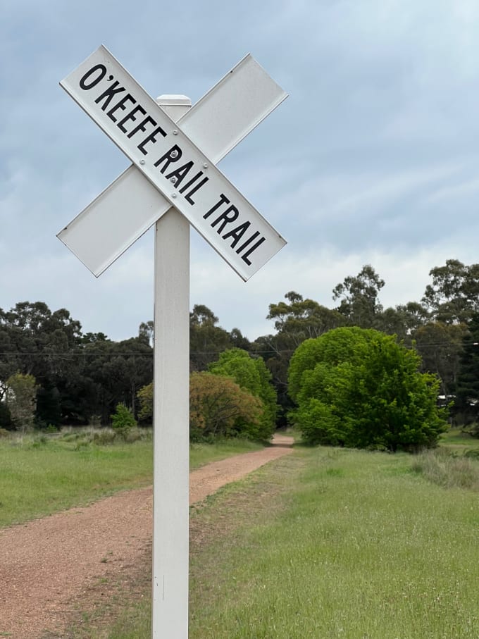
To sum it up: the first half of the Bendigo Graveleur has a lot of hidden turns[1], technical single-track, and sudden steep uphill climbs on loose rocks. It largely follows the route of the Goldfields Track. The second half is a comparative breeze. It breaks off and meets up with the O’Keefe Rail Trail back to Bendigo.
Here’s a daily breakdown of the ride. The three non-bolded rows links out to their corresponding Strava rides.
| Leg | Distance | Elevation Gain |
|---|---|---|
| First half | ||
| Bendigo to Goom Gooruduron-yeran | 23.18 km | 296 m |
| Goom Gooruduron-yeran to Mia Mia | 67.51 km | 1,135 m |
| Second half | ||
| Mia Mia to Bendigo | 77.88 km | 626 m |
My bike was about twice it’s usual weight once fully laden, going from 16kg to (an embarrassing) 32kg[2]. That additional weight had a huge impact on my ability to climb, steer, and therefore the mileage each day.
This was one of those rides that I should have been nimble for. Sleeping rough or in accommodation (not packing a tent) and eating out (not packing so much food or any cooking gear) would have helped.
First half
I caught the V/Line[3] from Melbourne’s Southern Cross Station to Bendigo, getting in just after 2pm. The starting point of the trail is a short ride south-west from Bendigo Station.
The first 13 km is mostly single-track and heavily rutted. You’ll find great signage and then—at a critical turn—no signage at all. Have your GPS at the ready.
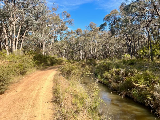
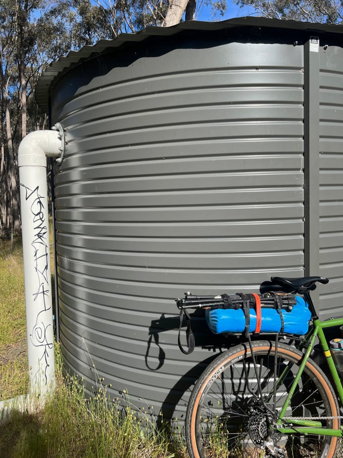
Sandhurst Reservoir marks the beginning of sanity. This is where you meet up with the Coliban Main Channel and ride alongside it for about 7 km to Goom Gooruduron-yeran campsite and rainwater tank.
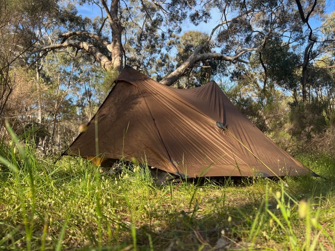
I pulled in here for the night. Unless you’re slow or a late-starter like I was, you’ll probably want to push on.
That said, it was a great campsite. Nice grassy areas to pitch a tent, a clear firepit, and rainwater a short walk away. Bring a water filter[4] as you’ll be relying on rainwater tanks like this one until Heathcote.
The ride from Goom Gooruduron-yeran to the crest of Mount Alexander is the toughest hardest part of the Bendigo Graveleur. Loose rocks and steep climbs kick in soon after leaving camp. The road becomes sealed once you approach the Mount Alexander Regional Park but the climb gets steeper.
I was knackered by the time I reached the crest so didn’t take any photos of the nearby Dog Rocks or lookout. It’s worth a stop if you have the time.
The nearby Leanganook campsite has a rainwater tank, toilet block, and picnic benches. I’m not sure about the suitability for tents as it was mainly compacted soil and Boomers with giant caravans.
The next 15 km to Metcalfe is your (mostly) downhill reward for the earlier uphill slog. Good roads, minimal traffic.
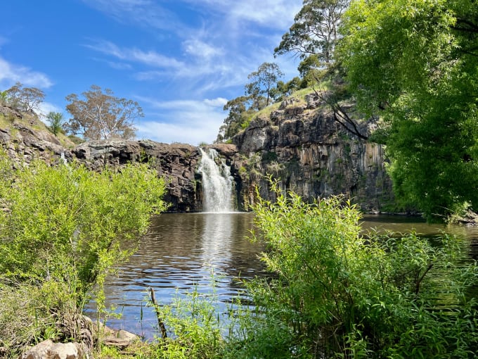
Metcalfe itself isn’t much worth stopping for, although I didn’t allow myself the short detour to the Cascades. I should have done this in retrospect, considering Turpins Falls is now permanently closed.
I also denied myself the Ridge Track detour through Metcalfe Nature Conservation Reserve. Not sure what I was thinking. I was probably still stuffed from the earlier climb and nervous about finding somewhere to camp come dusk.
Turpins Falls was too much for me to resist despite being permanently closed. Prepare for a huge concrete barrier and needing to shimmy your bike through sheep carcasses. Obviously have your wits about you too. It’s closed for good reason: it’s dangerous. People die here.
You’ll link back up with Heathcote-Kyneton Road shortly after Turpins Falls. Try to avoid the afternoon traffic as the shoulders of the road are either narrow or non-existant.
I missed the lunch and dinner windows at Redesdale Hotel so can’t speak to its quality. I also couldn’t stay overnight because their accommodation area was under repair and their ‘pub camping’ area too wet. I’d call ahead or stealth-camp across the road.
The road from Redesdale to Mia Mia is even more dangerous than the one before it. Blind corners, fast cars, and no shoulder. The descent, bends, and Redesdale/Mia Mia Bridge are good fun though. Again, do what you can to avoid peak hour.
I pulled stumps at Mia Mia’s cricket oval on a whim. It ended up being the perfect spot; a toilet block, running water (which might not be potable), and even power outlets, tables, and chairs at the clubhouse.
In retrospect, I could have waited to have dinner in Redesdale and then ridden the 5 km to Mia Mia in the dark. I actually slept on the clubhouse outdoor sofa, not bothering to pitch the tent.
Be careful where you pitch your tent as a convoy of cars and a caravan pulled up in the dark and in a hurry. You’re next to a busy road so I get the feeling this happens often.
Second half
Kick back from this point onwards. You’ve made it past the climbs, ruts, and most of the cars. You’ll even re-enter civilisation in about 26 km once you reach Heathcote.
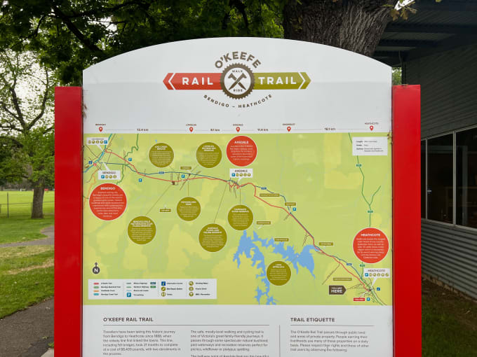
Heathcote has coffee shops, a supermarket, information center, etc. It’s also the start of the O’Keefe Rail Trail.
Axedale is the one other major town on the way in to Bendigo. I was in a riding mood so didn’t stop for long, nor for photos. In fact I didn’t really stop at all.
Maybe the flat, well-graded ride was a bit boring. Maybe I actually liked the slog over the previous two days. Maybe I just wanted to get home.
Wrap up
If I did this ride again I’d aim to start early and stay in accommodation around Redesdale. That would take off the bulk of the weight and make the western side less of a slog.
Camping is more fun though and maybe your only option. In that case I’d start early, go clockwise, and stealth-camp in Redesdale (or call ahead and camp at the Redesdale hotel). I’d eat lunch on the way in Axedale or Heathcote and dinner upon arrival at the Redesdale Hotel.
That would give you the whole next day to (start early and) tackle the climbs, without the weight of cooking gear or extra food. You could take it easy knowing that trains from Bendigo leave every hour back to Melbourne late into the evening.
This is the trip that made me come around to the idea of getting one of those handlebar-mounted GPS computers. I found myself stopping too often to pull out my phone. ↩︎
My bikepacking bike is also my commuter bike, so I run front and rear racks permanently. Plus a lock. Subtracting the food I didn’t eat, spare water and gear I didn’t need, and front rack (which I was too lazy to take off), I could have gotten the weight down from 32kg to about 26kg. ↩︎
This was my first time on the V/Line with a bike. It was great. No dismantling into bike boxes or extra tickets to deal with. Just roll your bike in and strap it to the dedicated storage area which is within sight of the seats. ↩︎
I use a Sawyer Mini Water Filter that my brother gave me. ↩︎